|
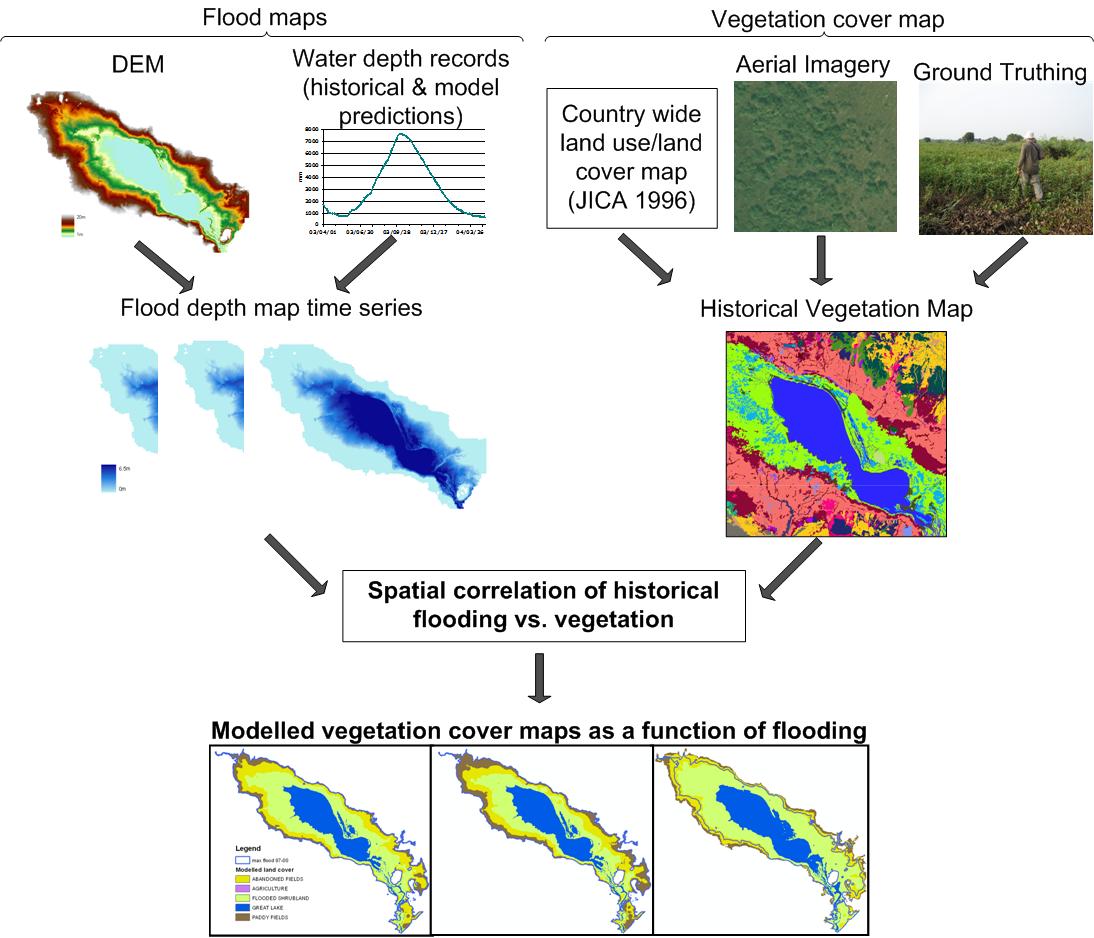
We have been able to show that there is a clear connection between the identity and structure of habitats and the flooding regime of the Tonle Sap. We established an empirical relationship between decadal patterns of flood duration and habitat type and we used this to project maps of likely habitat cover in the future as a result of alterations caused by climate change and water resources development. Projected maps have been used to estimate changes in habitat usage of representative fauna species, as well as projections of changes to aquatic primary production and sedimentation.

Related publications:
Arias, M.E., Cochrane, T.A., Piman, T., Kummu, M., Caruso, B., and Killeen, T.J. (2012) Quantifying changes in flooding and habitats in the Tonle Sap Lake (Cambodia) caused by water infrastructure development and climate change in the Mekong Basin. Journal of Environmental Management, http://dx.doi.org/10.1016/j.jenvman.2012.07.003
Arias, M.E., Cochrane, T.A., Elliott, V. (2013) Modelling future changes of habitat and fauna in the Tonle Sap wetland of the Mekong. Environmental Conservation, doi:10.1017/S0376892913000283.
Arias, M.E., Cochrane, T.A., Kummu, M., Lauri, H., Koponen, J., Holtgrieve, G.W., and Piman, T. (2013) Impacts of hydropower and climate change on drivers of ecological productivity of Southeast Asia’s most important wetland. (In review, Ecological Modelling)
|